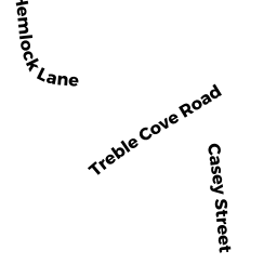
0 REAR TREBLE COVE RD
BILLERICA, MA01862
Owner Information
MATERNE RUSSELL K.
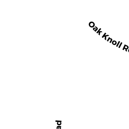
140 OAK KNOLL RD.
CARLISLE, MA 01741


Property Details
0 REAR TREBLE COVE RD is classified as a Undevelopable Residential Land.
0 REAR TREBLE COVE RD is valued at $17,900. The land is valued at $17,900 and the structures are valued at $0.
0 REAR TREBLE COVE RD was last sold on Thursday, December 19, 1991 for $470,000.
Assessment data from fiscal year 2022.
Flood Data
According to the FEMA National Flood Hazard Layer, this property does not appear to be in a flood zone. It may also be in an area not yet reviewed. Nonetheless, confirm this information prior to taking any action.
To view the flood hazards around this property, create a FEMA "Firmette" Map of the area around 0 REAR TREBLE COVE RD.
Broadband Internet Providers
| Provider | Type | Bandwidth (mbps) | |
|---|---|---|---|
| Viasat Inc | Satellite | 100 | 3 |
| Verizon New England Inc. | Fiber | 940 | 880 |
| Comcast | Cable | 1000 | 35 |
| GCI Communication Corp. | Satellite | 0 | 0 |
| HughesNet | Satellite | 25 | 3 |
| VSAT Systems, LLC. | Satellite | 2 | 1 |
Broadband service provider data from December 2020.
Adjacent Properties
- 30 REAR WEST ST
United States Government owned by UNITED STATES OF AMERICA - 0 REAR TREBLE COVE RD
Undevelopable Residential Land owned by DEKOCK JONATHAN LEE - 0 TREBLE COVE RD
Undevelopable Residential Land owned by PATRICIA A ROBBINS 2016 TRUST - 425 TREBLE COVE RD
Single Family Residential owned by O`MAHONY EDWARD V - 423 TREBLE COVE RD
Single Family Residential owned by MCLAUGHLIN RICHARD H.